


Caithness
Caithness is located on the north-eastern tip of the Scottish mainland. Most of the county is low lying and relatively flat, but from a topographic and fishing perspective there are 2 very different environments.
To the west and to the south is the ‘Flow Country’ a large expanse of flat blanket bog scattered with peatland lochs. To the east and north, separated by a line running roughly from the east side of Loch Calder through Toftingall to Loch Hempriggs, lies fertile gently rolling farmland overlying soft limestone marls. This landscape produces waters rich in weed growth and invertebrates, resulting in extremely productive fisheries.
The peatland lochs should not be ignored however. The scenery and wildlife are unique, and although the average size of the fish may be smaller, there are also lochs with excellent quality fish. The marl lochs can become discoloured after high winds, so Calder, the Ulbster lochs and the Thrumster lochs to the south of Wick are worth keeping in mind for these conditions. Many of these lochs also offer good bank fishing, a useful option in wild weather.
With so many lochs to choose from, Caithness makes a great excursion destination for trout anglers, though it can equally fill a week or longer fishing holiday.
Being so far north, the season is short, running from mid April or May 1st to September 30th only.
There are 2 major salmon rivers in Caithness, the Wick and the Thurso, as well as Dunbeath Water and the River Berriedale that both flow into the Moray Firth, and Forss Water that pours out to the North Coast. The Thurso, the region’s most prolific salmon river rises in the Flow Country to the west, and runs for approximately 26 miles from its source at Loch More, to the town of Thurso on the North Coast.
The Wick River is a slow moving spate river that flows for about 12 miles from the hills south of the village of Watten, to Wick on the East Coast.
Here are some descriptions of some of the top trout and salmon fishing spots in Caithness:


Caithness Trout Lochs
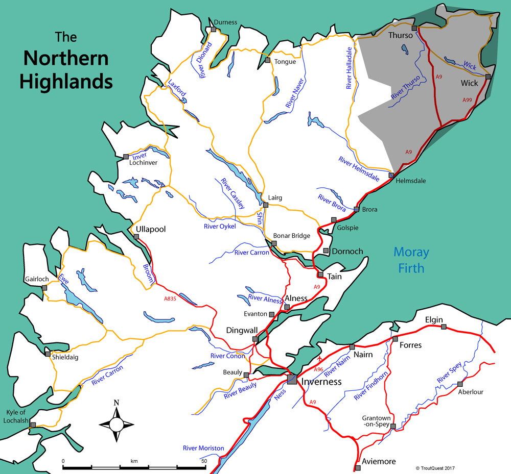
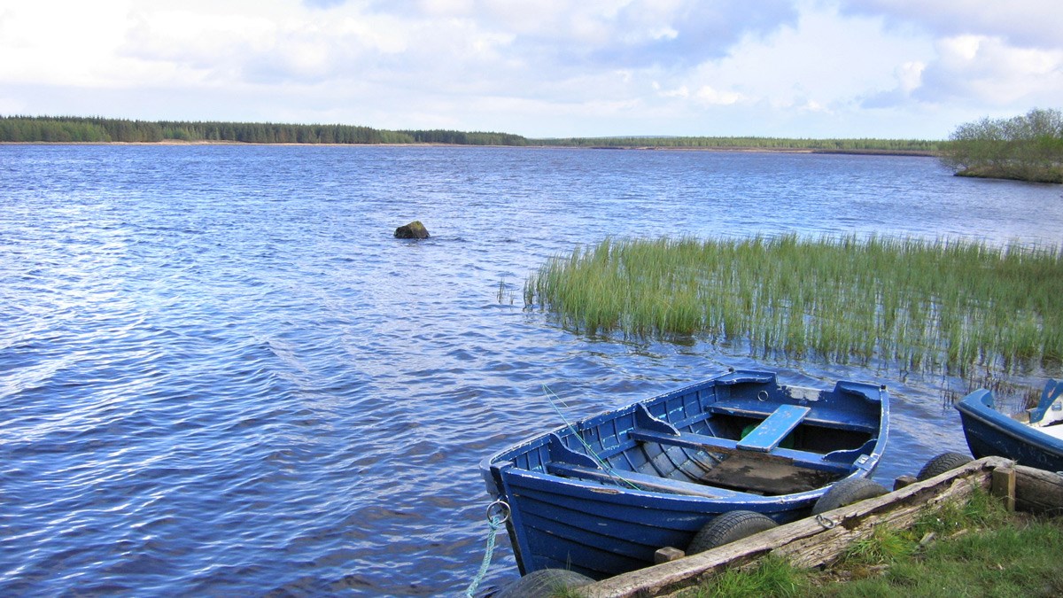
Loch Watten
Watten is the cream of the Caithness lochs offering traditional 'loch style' fishing at its best, and also rewarding modern dry fly and nymph tactics, depending on wind/wave state. It's a large marl loch, almost 3 miles in length, with a good average depth of 10-12 ft (2.5–3m), so the water tends to stay clearer after prolonged big winds, than on some of the shallower lochs. The wild brown trout average just under a pound, with good numbers of fish in the 2-3 lb class.
Boat hire/permits from Hugo Ross, Wick, Tel: 01955 604200.

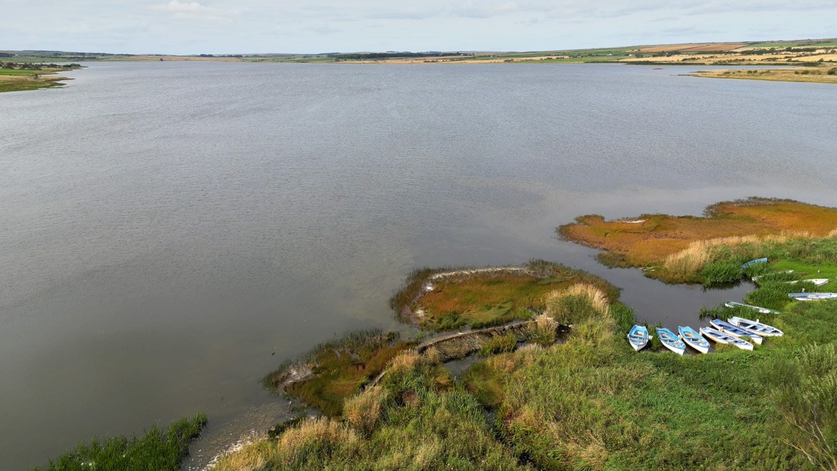
Loch Calder
Loch Calder reaches 28m in depth, and is bordered to the west by peatland with large exposed flagstone beaches. There are large numbers of trout in the ½ to ¾ lb range, and some much larger. Arctic char & ferox trout are also present. There is good accessible bank fishing on the E and N banks, and fishing is permitted on Sundays. A good option if blown off other lochs.
Boat hire from Dounreay FFA, through Harper's, Thurso, Tel: 01847 893179.
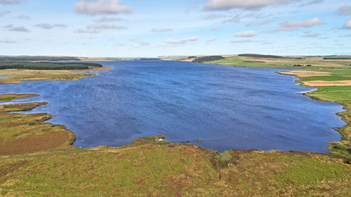
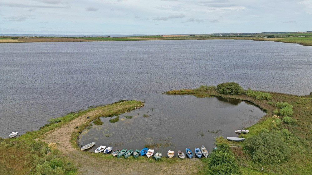
St. John's Loch
A shallow marl loch, typically only 5-6 ft (1.5 to 2m) in depth. Because of its shallow nature and marl bottom, it can be affected by heavy weed growth in the summer and discolours easily in periods of high winds. The trout average 1 lb, with several fish over 3 lb caught annually. The prime fishing is in late May until the end of June when there are prolific mayfly hatches. Bank fishing is allowed.
Boat hire/permits from Hugo Ross, Wick, Tel: 01955 604200.
Loch Toftingall
Toftingall is another shallow marl loch lying in an interesting and secluded setting, surrounded on all sides by forestry plantation. Beautifully marked and varied brownies averaging about ¾ lb. Mayfly hatches and excellent bank fishing (wading).
Boat hire/permits from Hugo Ross, Wick, Tel: 01955 604200.
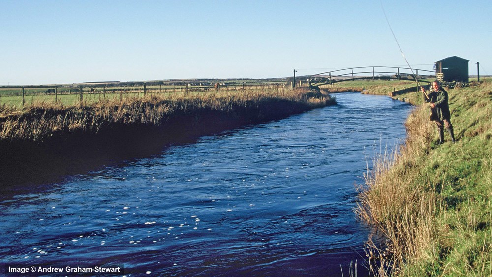
Wick River
| Main Season: May-Oct 15th | Category: 1 |
The Wick River is an unusual Highland salmon river in that its entire length of 12 miles, is controlled by Wick Angling Association, and fishing is available throughout to visitors.
It rises in an area of peatland to the north east of Stemster Hill, less than 200m above sea level. From there it flows north to Watten, then south-east to the coast. Despite its gentle descent and slow flow it is a spate river, and although extremely productive, it is essential to fish it after rainfall to enjoy success.
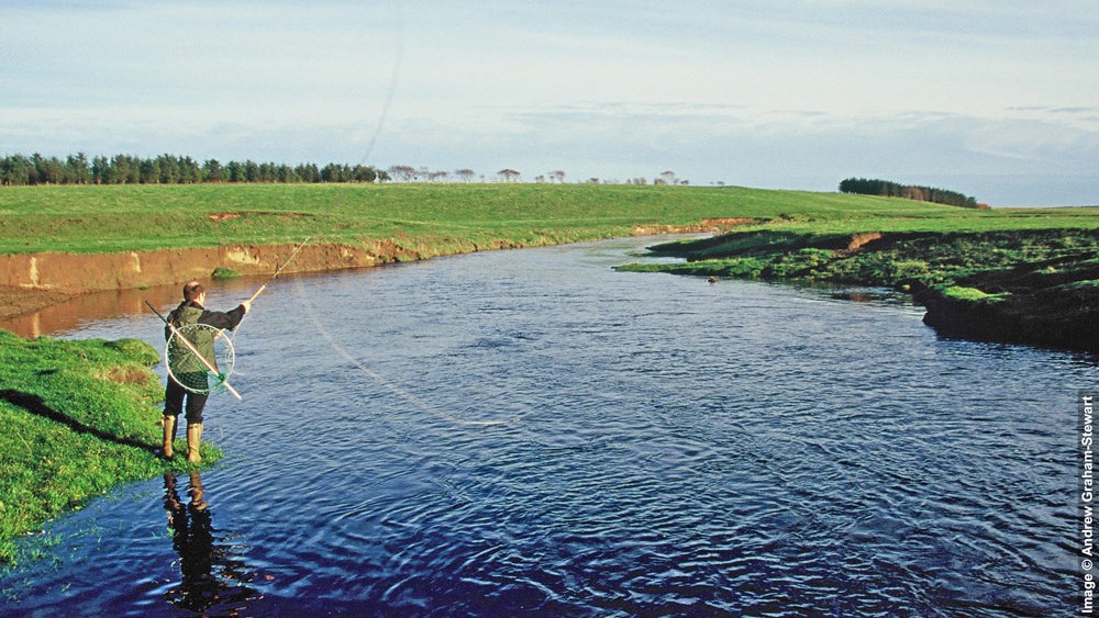
Wick Angling Club
Approximately 12 miles of double bank fishing and 40 named pools.
Permits from Hugo Ross Tackle, Wick. Tel: 01955 604200.
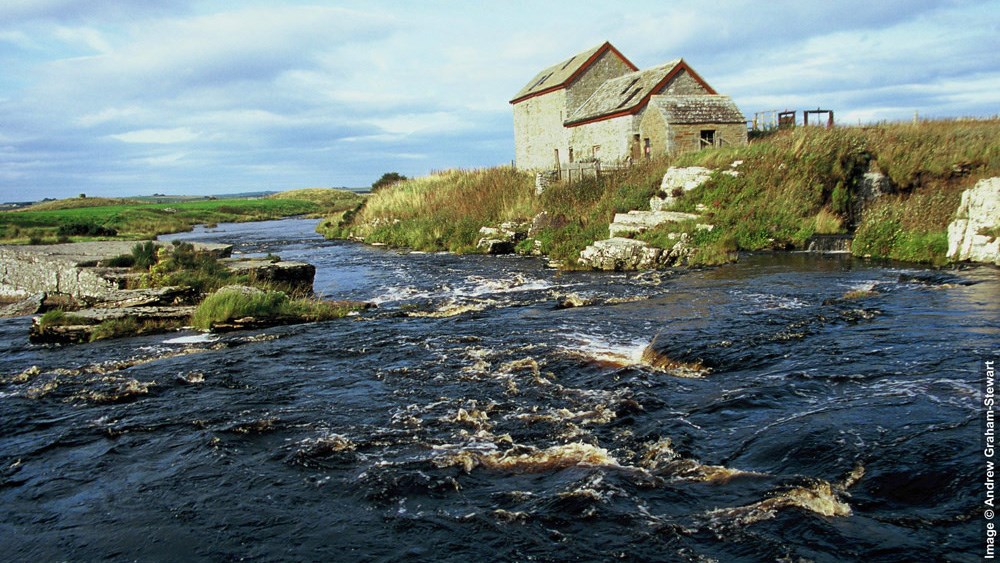
River Thurso
| Main Season: Mar-Oct 5th | Category: 1 |
The River Thurso’s source is in a large area of peatland or blanket bog, part of the ‘Flow Country’, to the south and south-west of Loch More. From the loch, the Thurso runs for approximately 26 miles to the north coast at the town of Thurso. The Thurso is one of the best salmon rivers in Scotland, typically producing 1300-1700 salmon/year.
The Thurso is split into 13 beats, 12 of which are controlled by the Thurso River Ltd, and let as advanced weekly lets. The success of the river in recent years has meant that there is rarely any fishing available on these private beats.
The lowest beat (Beat 1) is controlled by local anglers and members of the Thurso Angling Association, who also make some fishing available for visitors.
Thurso Angling Association - Beat 1
2.7 miles of river of which the lower 0.7 miles (Foundry Beat) is reserved for juniors trout fishing. The main part of this beat (Upper Beat One) is fished as a 4/5-rod beat in 2 sessions per day. 2 x visitor permits per half day.
Thurso Angling Association - Tidal Beat
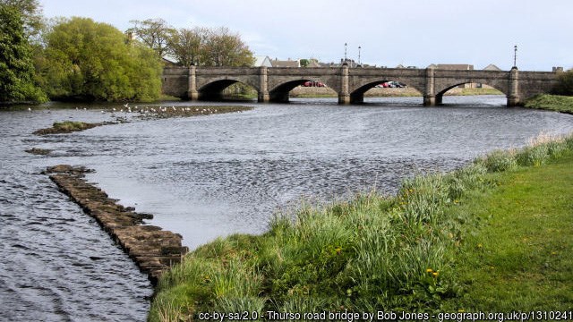
The Tidal Beat extends from the Town Bridge to the sea. 2 x visitor permits per half day.
Permits - Booking online.
 If you find this page informative, check out HiFly Fishing; our subscription-based website. The HiFly map has much wider coverage including Moray, Lochaber, Orkney, Skye, Mull & the Outer Hebrides with more than 5 x the number of fisheries.
In addition, the HiFly website has 5 x more fishery listings than displayed here. There are also >120 videos, including loch fly-overs such as in this clip ...